Ley Lines ?
I had never heard about ley lines until I read John Mitchell's book, The View over Atlantis. Early in the book, Mitchell described "the old straight track" and Alfred Watkins' (1855-1935) "...claim that he had seen the whole country [England] covered by a network of straight lines, linking centres and sites of antiquity..." Watkins backed up his claim with extensive, precise surveying work. Mitchell went on to describe prehistoric and more modern sacred sites, and to conjecture what significance these lines may have had. He also described similar things outside of England, including the "dragon lines" of China and the Great Pyramid of Egypt.
Since I was living in Catalunya at the time, and was familiar with some local prehistoric constructions, I decided to check whether there was any evidence of similar lines in my neighborhood. These maps show what I found.
To find five things in a row over the course of a few miles would be completely unremarkable. Almost everywhere you look that would be the case. But to find five "copies of the same thing" precisely lined up, and separated by even multiples of a precise distance - that is highly improbable. We start to look for a designer and ask, "Why?"
But, to whatever extent (at age 27) I may have bought into John Mitchell's visions of boulders gliding along magnetic lines in stately progression directed by flute-playing savants who rode them from one sacred site to another, forty years later I look at these lines I discovered, and I think that something remarkable is there, calling to me with its own special music.
 For higher resolution.
On the Map
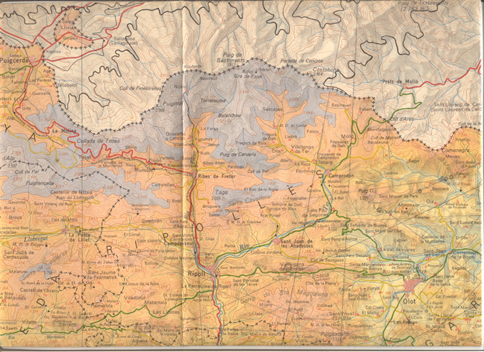
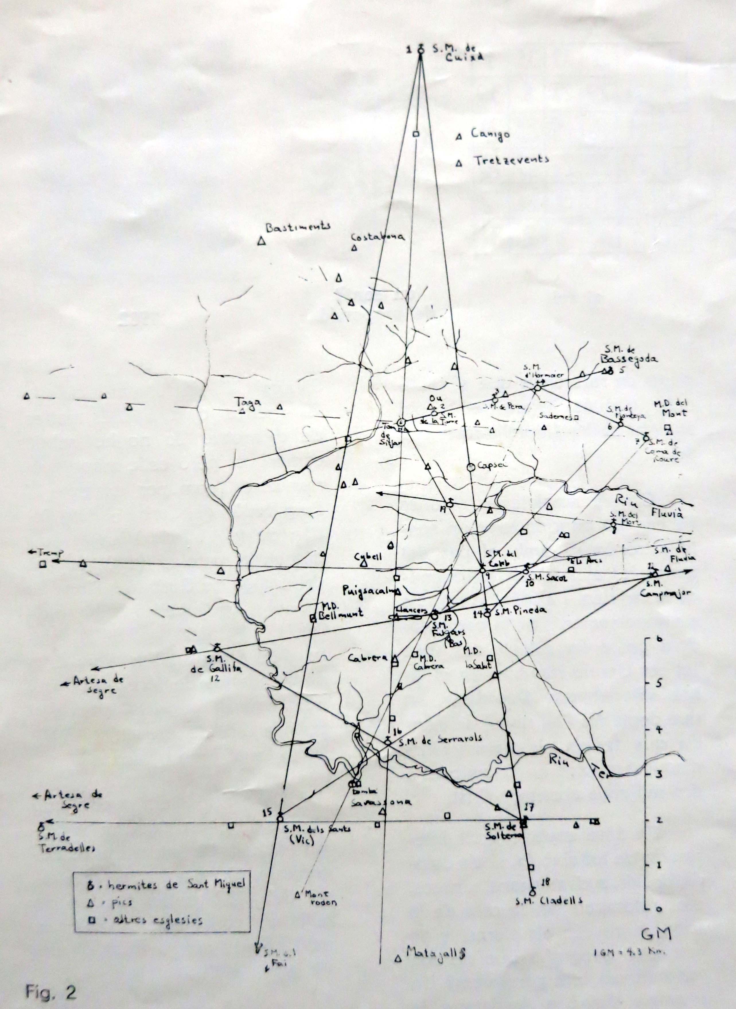
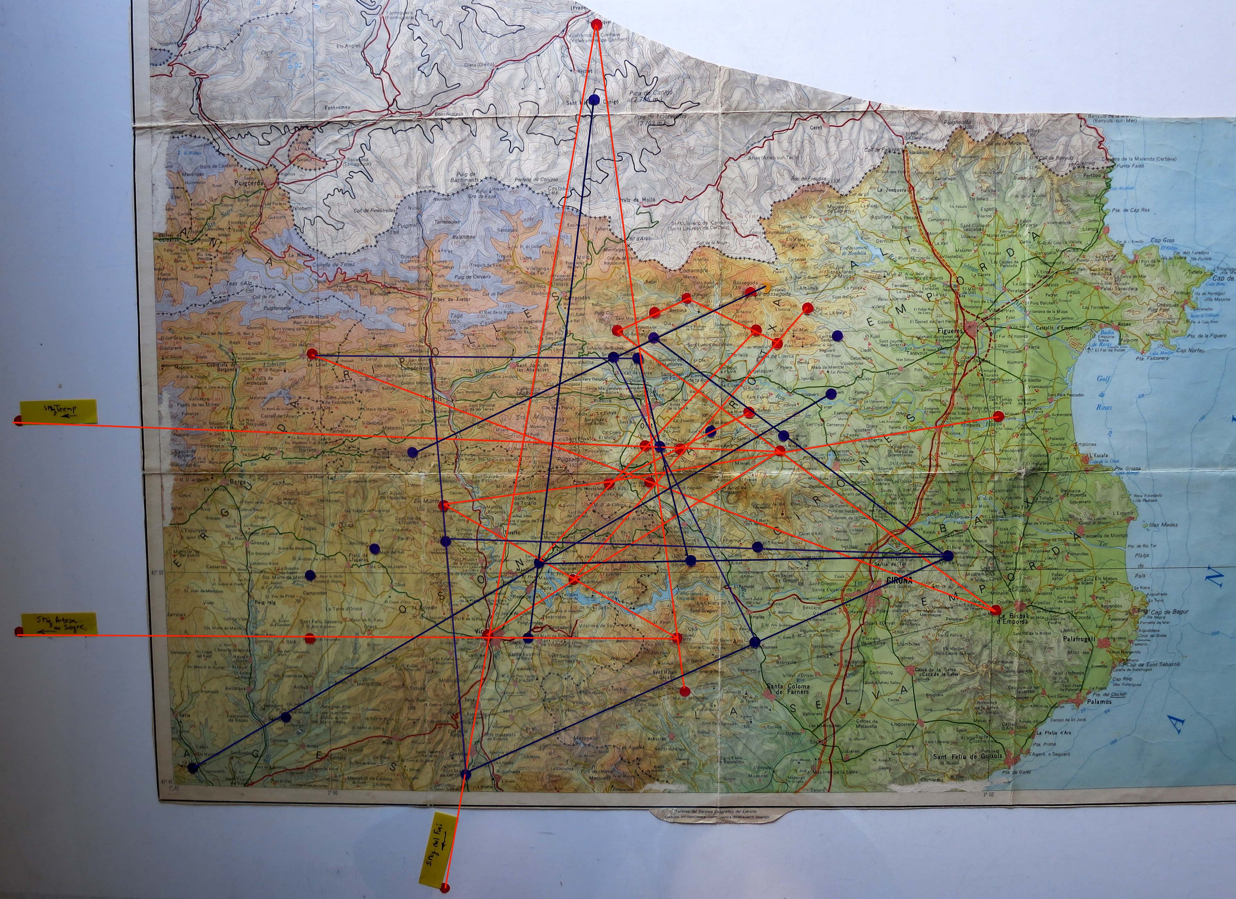
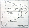
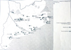
What I found was a five-pointed star - straight lines (each with three to six points in a row) coursing over churches and hermitages dedicated to Saint Michael, with Sant Miquel de Cuixa (on the peak of the prominent mountain, el Canigo in the southern French Pyrenees) as the top point, and the horizontal crossbar aligned along the forty-second parallel, aiming towards Santiago de Compostela ("field of stars"?), one of the main pilgrimage destinations of the Middle Ages, on the Atlantic coast of Spain. Several of the points were separated by even multiples of the geomancer's mile (1GM=2.72English miles), which Mitchell claimed was the measurement employed in antiquity. I published these findings in the magazine Verntallat in the summer of 1978.
Some of these lines also crossed over the menhirs and dolmens I was familiar with. It was Mitchell's contention that post neolithic religions built their temples on top of the holy places from the Megalithic Era. My plan to continue investigating this was cut short as I had to leave Spain, and, unfortunately, haven't been able to return.
Some time later it occurred to me to check the alignments of the Saint Martin hermitages on the map. I found that they are joined by another series of straight lines paralleling the Saint Michael's lines.
Who ?
Whatever may remain of prehistoric elements in this network, the design of the network of Romanesque churches and hermitages dedicated to Saint Michael (Archangel) is due to the influence of Oliba (971-1046), born count of Berga and Ripoll, who became bishop of Vic and abbot of the monasteries of Santa Maria de Ripoll and Sant Miquel de Cuixa, and founder of the monastery of Santa Maria de Montserrat. He bridged the end of the Arab occupation of Catalunya (at the same time translating Arabic manuscripts into Latin) and is considered one of the spiritual founders of Catalunya.
Why ?
My intuitive feel for this phenomenon (from being there and looking at the landscape) has been to see it as a carefully analyzed appreciation of geology from a "primitive" point of view. As Alfred Watkins thought, these points and lines break down the landscape into easily understood trajectories for the traveler. Sighting points are clearly established, and the next day's journey broken down to a doable hike.
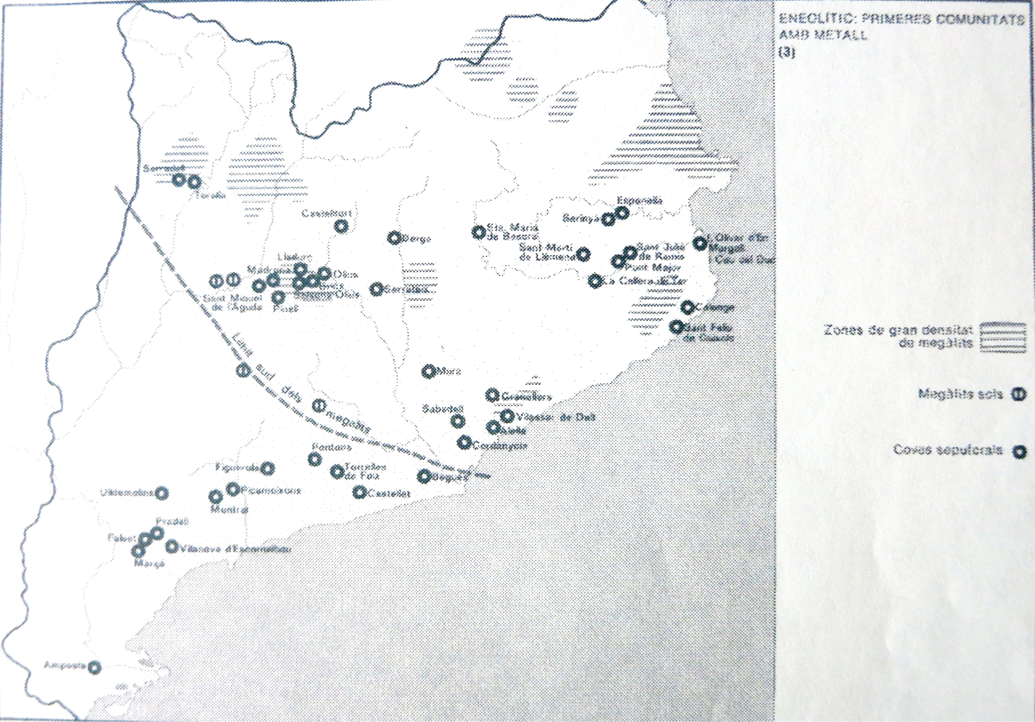
The San Miquel hermitages are also concentrated in the region of Catalunya above the Southern limits of megalithic constructions, as seen in the Atlas de Catalunya.
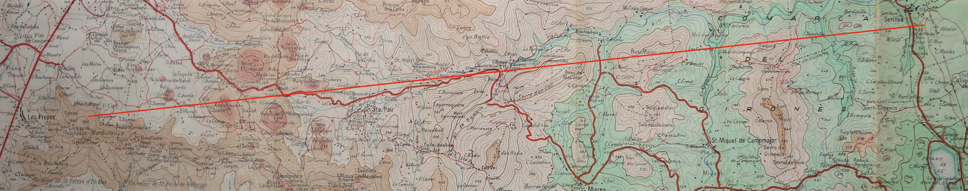
Considering how pieces of the earth fold, push up and twist (in the middle of this star is a geologic twist that resulted in volcanic "pimples"; the drawing is from a geologic study by J.Ma.Mallarach, showing geological fault lines seen from the ERST satellite and the volcanoes of Olot, 1978. The twisting also resulted in the formation of the Pyrenees), I'm also ready to imagine that, in a time of less insistent sensory input, our ancestors may have been able to feel physical (electromagnetic?) forces coming out of particular points. These became "sacred" and were eventually marked with stone constructions.
Later religions, in order to wean the local populace away from the old cult, built their new temples on the same locations (knowing that the people would be going there anyway), and either destroyed the old stones or insisted that they now be called "devil stones". This was the case for the menhir closest to where I lived.